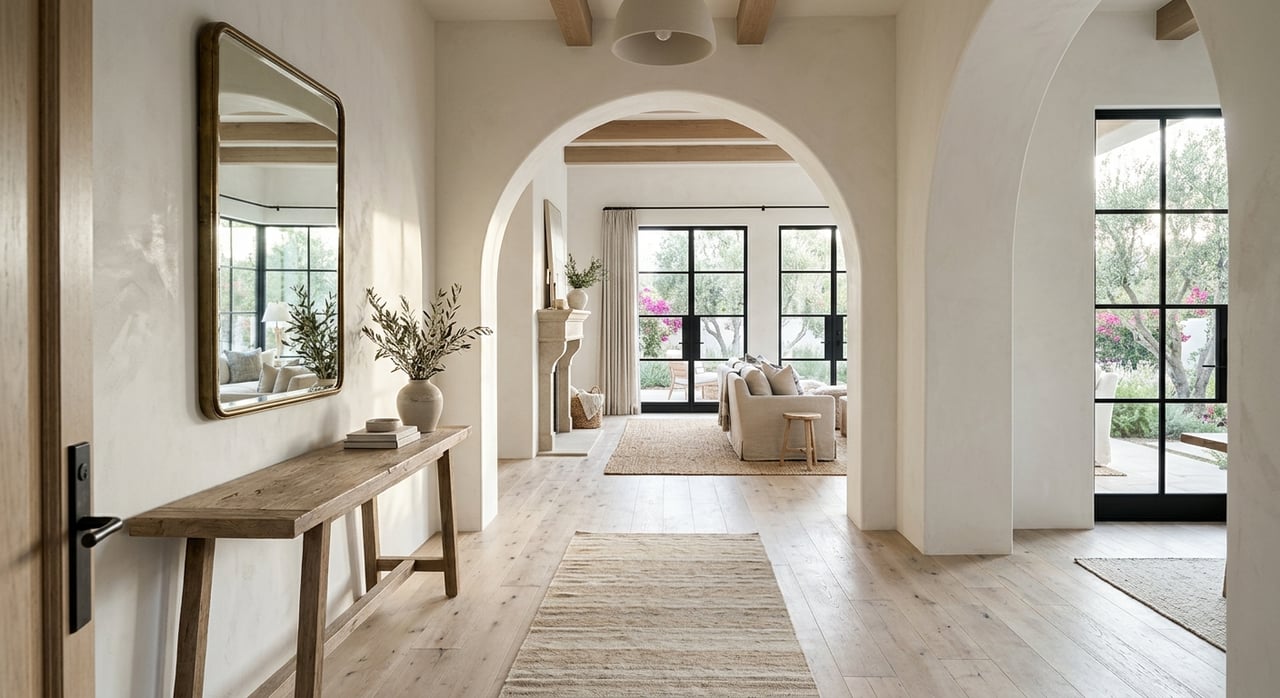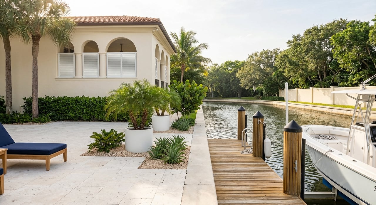
If your perfect day begins on the water and ends with a sunset cruise, Port Royal in Naples can make that rhythm your everyday life. The neighborhood’s deep-water setting, direct bay access, and short run to the Gulf draw boaters who want both convenience and comfort. In this guide, you’ll learn how Port Royal’s canals work, what to know about docks and services, and the permits and insurance that shape waterfront ownership in 34102. You’ll also get a practical checklist you can use as you evaluate any property. Let’s dive in.
Why Port Royal suits boaters
Fast Gulf access via Gordon Pass
Port Royal and neighboring Aqualane Shores sit on the west side of Naples Bay, with Gordon Pass as the primary inlet to the Gulf of Mexico. Gordon Pass is a federally recognized navigation inlet that has historically been maintained to keep a reliable route to open water. For background on how this inlet has shaped boating here, see this overview of the historical geography of Southwest Florida waterways.
No fixed bridge routes to the Gulf
Many waterfront lots in Port Royal and Aqualane Shores open directly to Naples Bay or connect by canals without fixed bridges between the private dock and Gordon Pass. That clean route is a key reason you see larger boats here. Still, every lot is different, so confirm usable depth and turning room before you assume a certain vessel will fit.
Tides, currents and seasonal changes
Naples Bay has a modest tidal range. Even small changes in tidal stage, inlet shoaling, or post-storm shifts can affect safe draft. Always check current NOAA tidal data and local channel notices, and plan with mean low water in mind.
Canal types and what they mean
Bayfront lots
Bayfront parcels face open water on Naples Bay. You get the easiest maneuvering for large yachts and no tight canal turns. Exposure to wind and chop can be higher than interior canals, which matters for tender use and day-to-day comfort at the dock.
Main and end-of-canal locations
Homes on the wider primary canals or at canal ends often enjoy protected mooring with better turning radiuses. Suitability for bigger boats depends on measured canal width, any turning basin nearby, and documented depth at mean low tide.
Narrow finger canals
Shorter, narrower interior canals are ideal for smaller center consoles and runabouts. Larger vessels can be limited by both draft and the space needed to turn. If you plan to keep a longer or beamier boat, confirm clear geometry from your slip to the bay.
Depth, draft and turning room
A few practical thresholds help you sort options:
- Small center consoles and runabouts often draw under about 2 to 3 feet and tolerate narrower, shallower canals.
- Mid-size express cruisers or sportfishing boats around 25 to 40 feet usually need multiple feet of water at mean low tide plus more room to turn.
- Large yachts from 50 to 100-plus feet require consistently deeper water, straight approaches, and either bayfront mooring or a turning basin.
Transit time to open water
Travel time to the Gulf depends on your exact route and speed. As a rule of thumb, at 20 knots one nautical mile takes about 3 minutes. Homes on bayfront or near the bay mouth can reach Gordon Pass in single-digit minutes by fast cruiser and in tens of minutes at slow cruise. Use your measured route, local markers, and an engine plan to estimate precisely.
Docks, power and nearby services
Common dock setups
You will see fixed piling docks with finger piers, T-head slips for larger boats, and some floating docks. Many homes have electric boat lifts. A few older properties have grandfathered covered boathouses or larger cut-in slips. New permitting tends to favor open slips and lifts over new boathouses.
Utilities and Naples City Dock
At private docks, shore power and potable water are common, though the exact service varies by property. For fuel and pump-out, the downtown public option is Naples City Dock in Crayton Cove, which offers ethanol-free gasoline, diesel, a 24/7 pump-out, and short-term transient services.
Haul-out and major service
Full-service marinas and yards in Naples and the wider Southwest Florida coast provide haul-out, mechanical work, rigging, and refits. Some very large yachts rely on regional yards outside the small canals of Port Royal. If you need heavy-lift capacity, confirm which nearby facility meets your vessel’s size and weight requirements. As one example resource for regional marine facilities, the Waterway Guide marina directory can help you preview capabilities.
Permits, environment and insurance
Local dock and seawall permits
For lots inside the City of Naples, the city administers marine permits. For unincorporated areas of the county, Collier County handles them. Expect engineered site plans, sealed drawings, and evidence of compliance with setbacks, waterway width rules, and any environmental review. Collier County’s Marine (PRMAR) application checklist outlines what is required for docks, lifts, seawalls, and marine demolition. You can review the PRMAR application requirements here.
Dock size and protrusion limits
Both the City of Naples and Collier County limit how far a dock can extend based on the width of the waterway. When a proposal exceeds the standard limit, the city or county looks at navigation impacts, water depth at mean low water, and neighbor effects. Some projects require hearings or added justification. For a plain-English overview of how Florida jurisdictions approach dock extensions, see this primer on residential boat dock extensions.
State and federal approvals
Work seaward of the Coastal Construction Control Line or projects affecting mangroves or seagrass can require Florida DEP permits and, in some cases, U.S. Army Corps authorization. That includes new seawalls, significant dredging, or activities on public submerged lands. You can learn more about the program at the Florida DEP CCCL page.
Flood zones and insurance
Many Gulf-facing and bayfront parcels in 34102 fall within FEMA Special Flood Hazard Areas, which can trigger mandatory flood insurance for financed purchases. FEMA’s Risk Rating 2.0 sets premiums based on individual property factors, such as distance to water, lowest floor height, and replacement cost, not just flood-zone letters. Expect premium variability and request quotes using the current elevation certificate during due diligence. For context, review the federal summary on Risk Rating 2.0.
Buyer checklist for waterfront fit
Use this quick list to focus your due diligence:
- Confirm jurisdiction. Verify whether the property is in the City of Naples or unincorporated Collier County, then review the relevant marine permit file. Start with the county’s PRMAR checklist and request any city records for Naples addresses.
- Measure real depth and room to turn. Ask for recent low-tide soundings and a diagram of the canal and turning basin. If you have a specific boat in mind, make the ability to safely handle it to and from the dock a contract condition.
- Inspect seawall and dock condition. Commission structural checks and get contractor estimates. Seawall work on public waters typically needs permits and can take months.
- Verify services. Confirm on-site shore power and water. Identify where you will refuel and pump out; Naples City Dock is the public option downtown.
- Price insurance early. Get NFIP and private flood quotes using the elevation certificate and make sure you understand how Risk Rating 2.0 can affect premiums.
- Consider wake, traffic and privacy. Main canals and channel entrances see more movement than cul-de-sacs or interior fingers, which affects comfort at the dock and tender use.
- Plan for service and haul-out. Confirm which local or regional yard fits your vessel’s length and weight, and whether any memberships or scheduling lead times affect your plan. The Waterway Guide directory is a useful starting point for capabilities.
Lifestyle tradeoffs to consider
- Bayfront ease vs exposure. Bayfront mooring simplifies maneuvering for large boats but can feel breezier and choppier. Interior canals are calmer but may be tighter for big vessels.
- Speed vs serenity. Quick runs to Gordon Pass come with more passing traffic. A deeper interior canal can be quieter, but verify draft and turning room.
- Old dock charm vs new standards. Some older properties have unique grandfathered features. New work must meet current code, so factor that into renovation plans and timelines.
How we help you decide
Choosing a Port Royal waterfront home is about more than a view. It is about matching your boating style with the right canal, dock, and route to the Gulf, then making sure permits, insurance, and maintenance align with your goals. If you want a steady hand to guide the process, we can help you set priorities, coordinate the right inspections, and negotiate with clarity.
Request a personal home valuation or contact Maureen to begin your property search. Connect with Maureen Sexson for a private consultation.
FAQs
What makes Port Royal in 34102 attractive for large yachts?
- Many lots have no fixed-bridge routes to Naples Bay and a short run to Gordon Pass, but always confirm depth and turning room for your specific vessel.
How long is the run from a Port Royal dock to the Gulf via Gordon Pass?
- It varies by location and speed; at 20 knots, one nautical mile is about 3 minutes, and bayfront homes can reach the pass in single-digit minutes at fast cruise.
Do I need permits to build or modify a dock in Port Royal, Naples?
- Yes; marine work requires city or county approval and engineered plans, starting with the county’s PRMAR checklist for guidance on submittals.
Where can I get fuel and pump-out service near Old Naples?
- The public option downtown is Naples City Dock, which offers ethanol-free gas, diesel, shore power packages, and a 24/7 pump-out.
How does flood insurance work for Port Royal waterfront homes?
- Many sites are in FEMA Special Flood Hazard Areas, and premiums under Risk Rating 2.0 depend on property-specific factors; get quotes using a current elevation certificate and review federal guidance.
What environmental permits might seawalls or dredging require in Naples?
- Projects seaward of the Coastal Construction Control Line or affecting mangroves or seagrass may need Florida DEP approval and possibly U.S. Army Corps authorization; see the Florida DEP CCCL program.